1 Before a Disaster
-
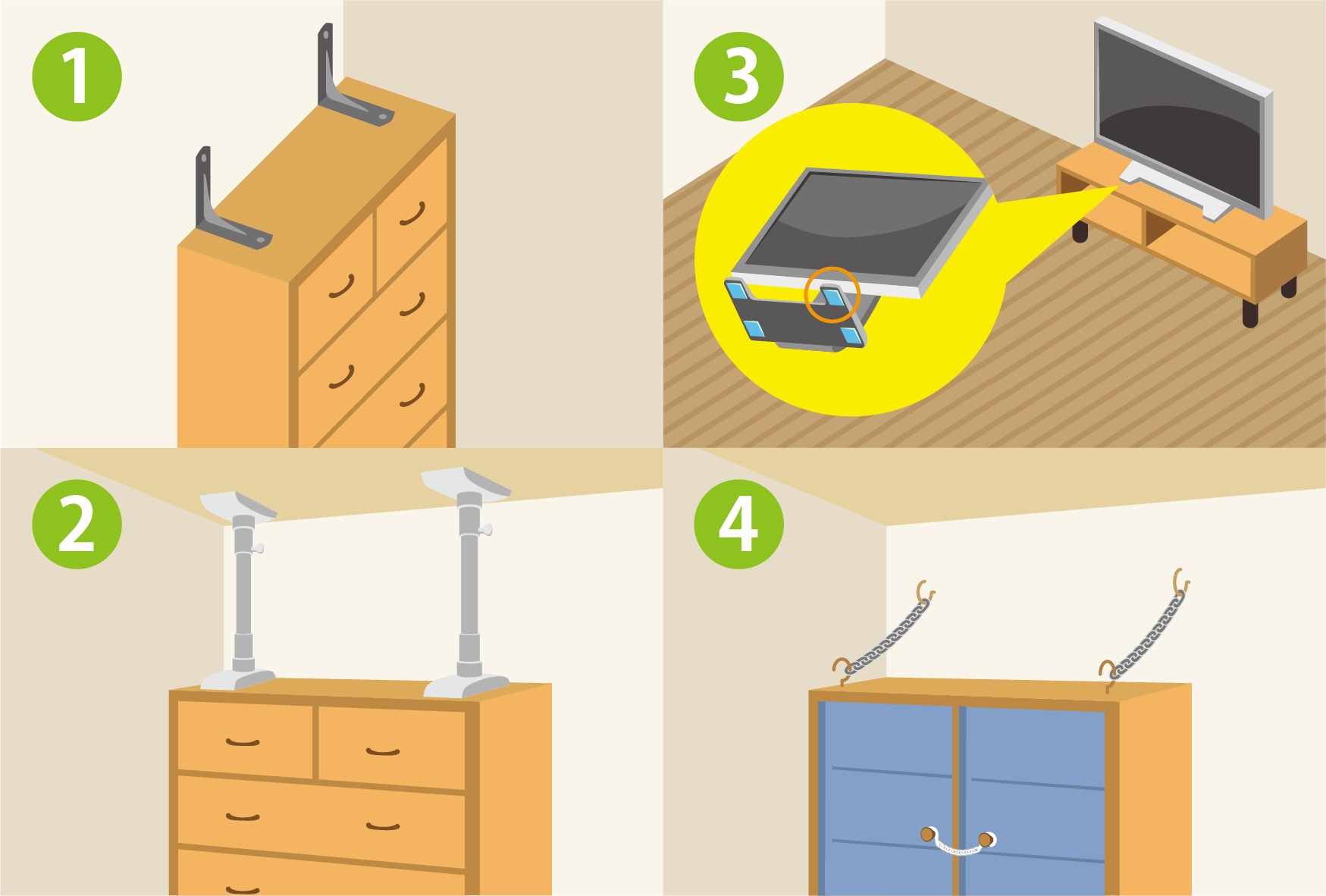
To be ready in the event of a disaster, you should prepare food and drinks, and make sure furniture is fixed in place.
It is also vital to decide on an emergency plan with your family.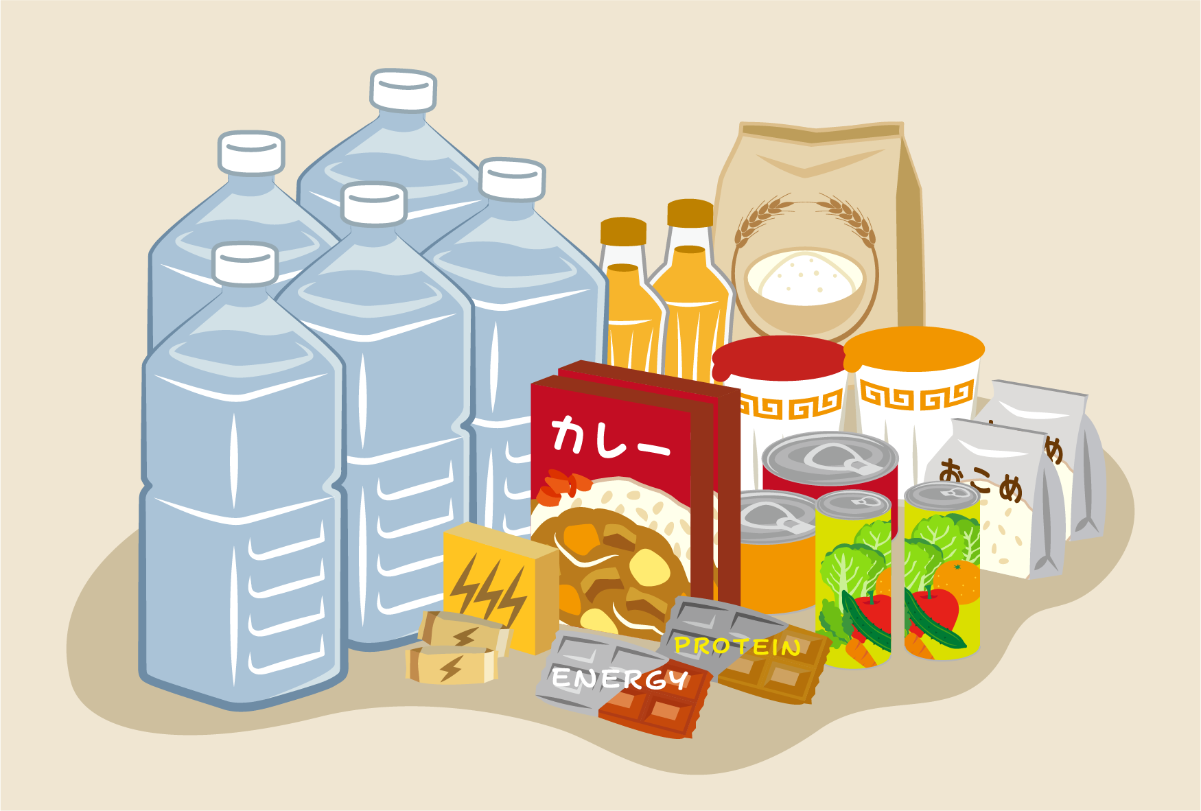
For details, please see the following page.
■Preparing for Disasters (TIPS)https://tabunka.tokyo-tsunagari.or.jp/disaster/howto/prepare.html(Japanese)
https://tabunka.tokyo-tsunagari.or.jp/english/disaster/howto/prepare.html(English)
-
Before the typhoon comes, prepare food and drinks, and secure outside objects indoors.
You should also confirm how dangerous your present location is, where you should evacuate to, and decide how to stay in contact with your family.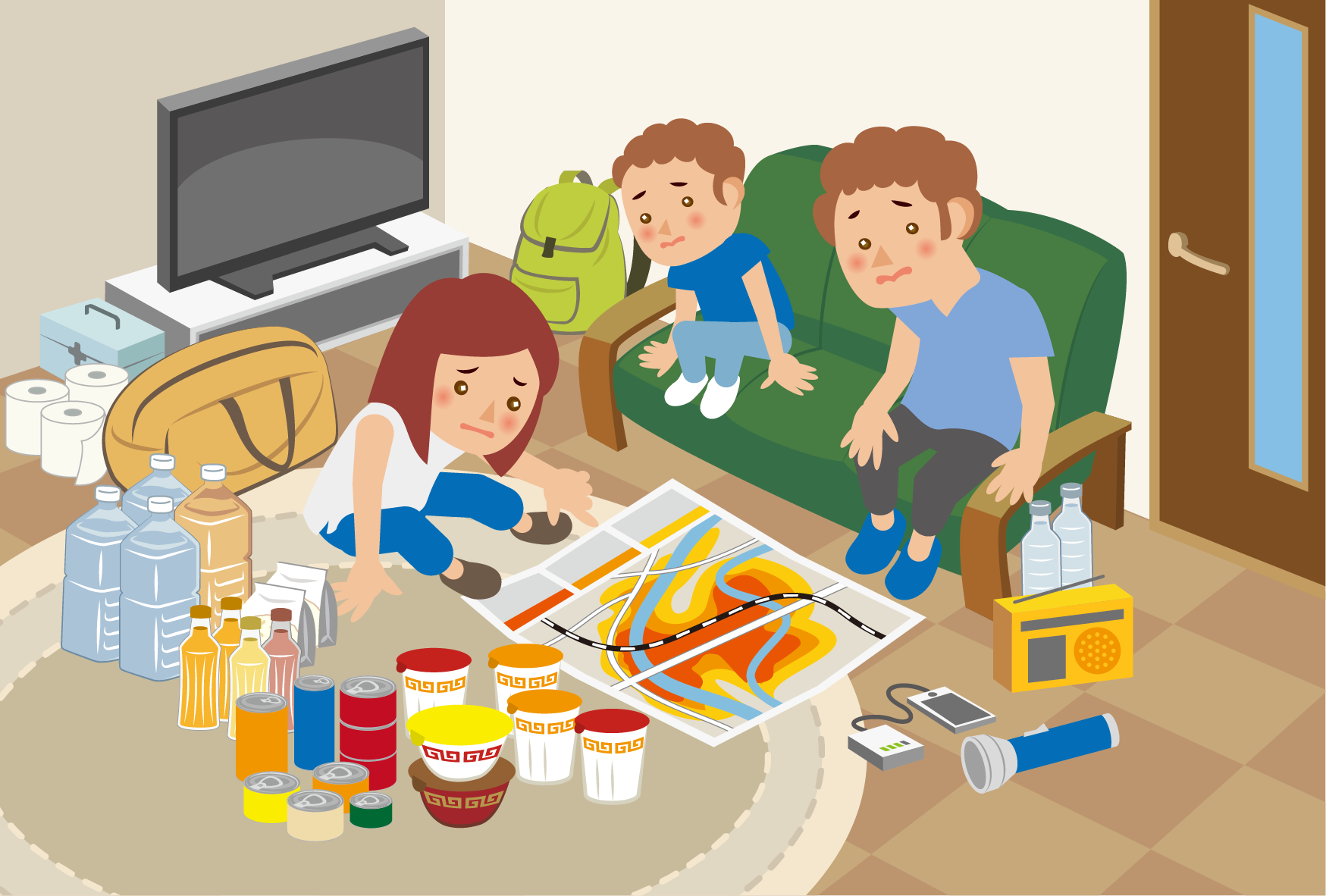
For details, please see the following page.
■Preparations Before Heavy Rains/Typhoons (TIPS)https://tabunka.tokyo-tsunagari.or.jp/disaster/howto/rainstorm.html(Japanese)
https://tabunka.tokyo-tsunagari.or.jp/english/disaster/howto/rainstorm.html(English)
-
Please refer to the following pages for information about heavy rainfall and typhoons.
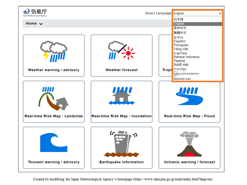
■Japan Meteorological Agency Website (14 languages)https://www.data.jma.go.jp/multi/index.html?lang=jp(Japanese)
https://www.data.jma.go.jp/multi/index.html?lang=en (English)
- On this site you can view weather forecasts and information about heavy rains and typhoons.
- The map is color-coded to show areas that will be affected by landslides, inundation, and flooding. Check the color of your present location and evacuate promptly if appropriate.
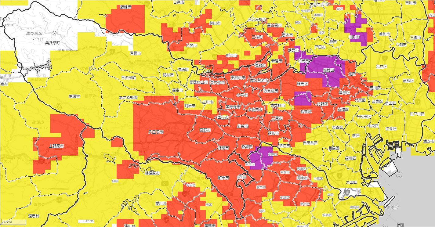
See the site below for an explanation on how to read the landslide, inundation, and flood maps.
■ About KIKIKURU (Real-time Risk Map) (TIPS)https://tabunka.tokyo-tsunagari.or.jp/disaster/howto/hazard_distribution.html(Japanese)
https://tabunka.tokyo-tsunagari.or.jp/english/disaster/howto/hazard_distribution.html(English)
-
-
During typhoons and heavy rains, rivers can overflow, mountainsides can collapse and wind can send objects flying. Do not go outside unless you are evacuating.
-
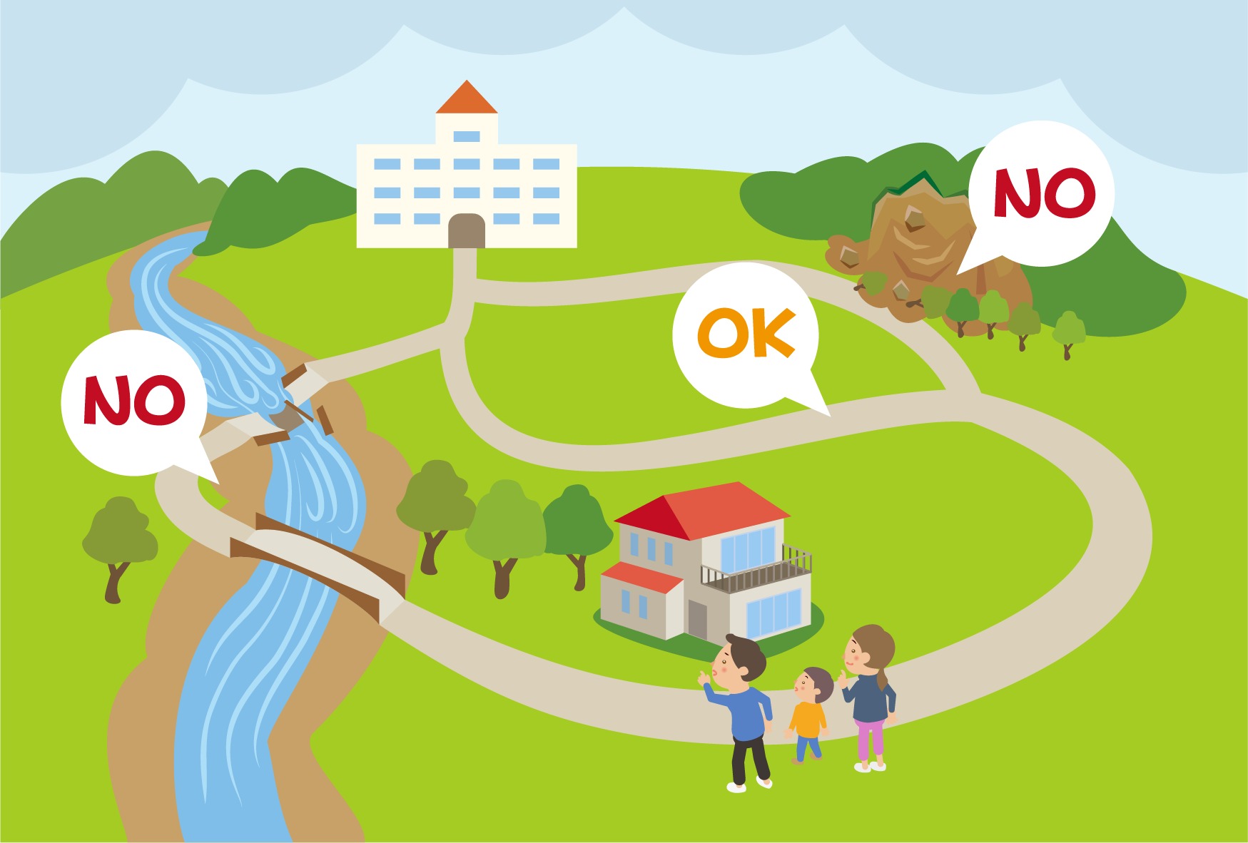
If you have to go outside, avoid rivers and mountains.
Stay out of basements and away from underpasses.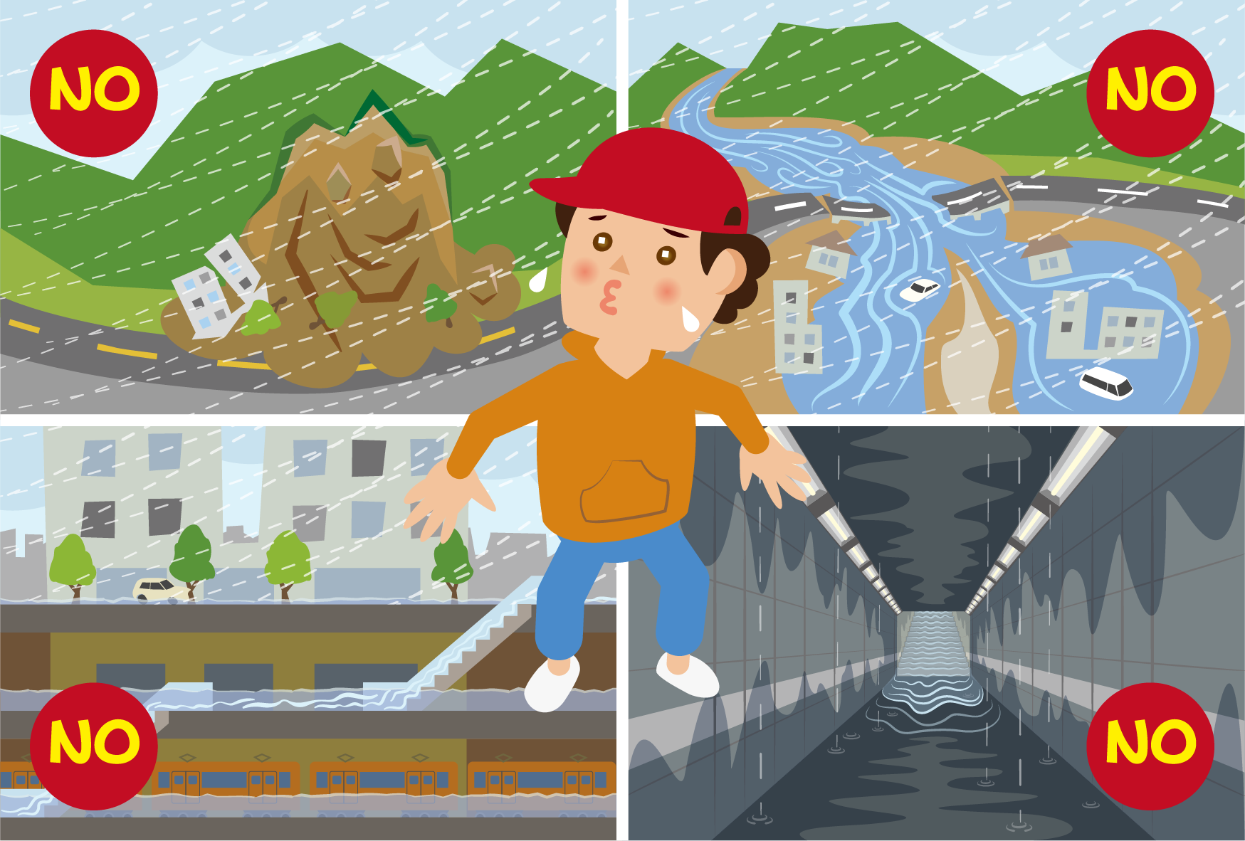
-
-
-
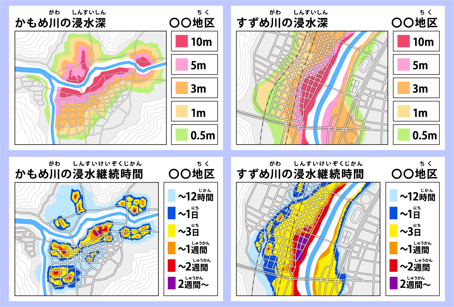
Check hazard maps to see how much water is expected to come.
■About Flood Hazard Maps (TIPS)
See the following page for an explanation on how to read hazard maps.https://tabunka.tokyo-tsunagari.or.jp/disaster/howto/hazard_maps.html (Japanese)
https://tabunka.tokyo-tsunagari.or.jp/english/disaster/howto/hazard_maps.html (English)
-
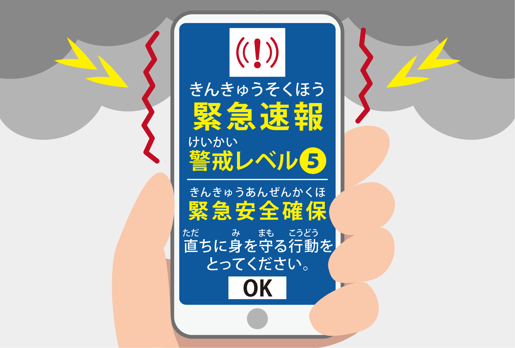
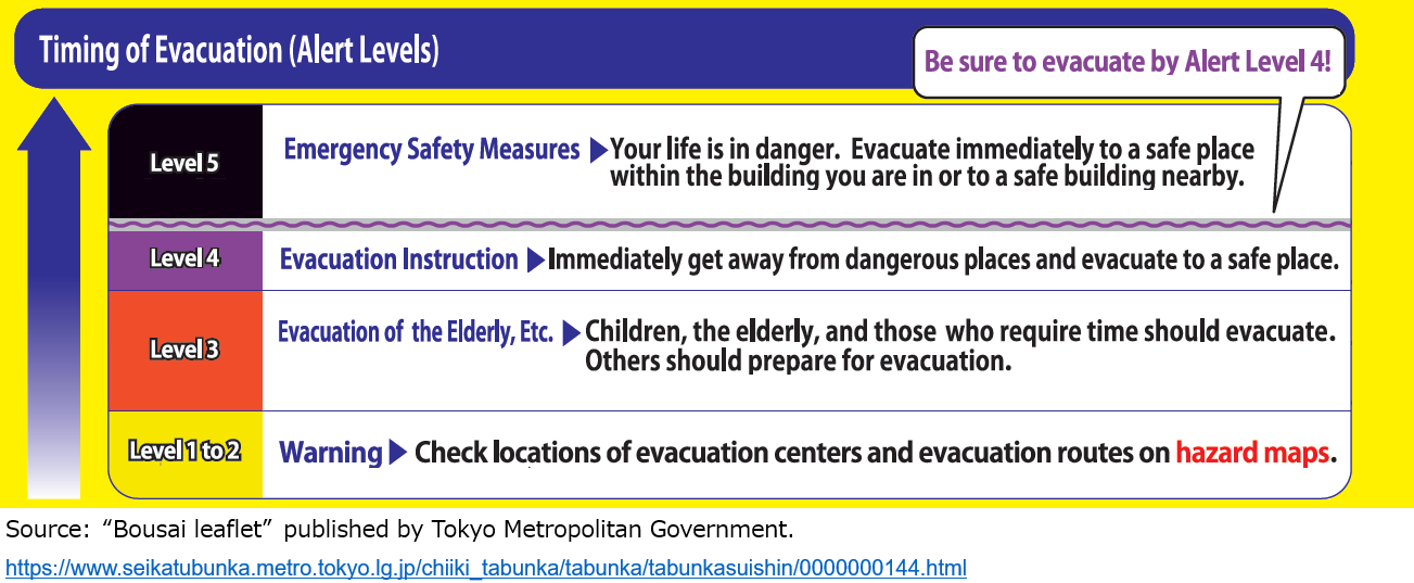
When it's possible that a natural disaster will occur, the Japan Meteorological Agency and local government will issue an "Alert Level". Check the Alert Level for your area and take appropriate actions depending on the level.
■Alert Levels (TIPS)
For details, please see the following page.https://tabunka.tokyo-tsunagari.or.jp/disaster/howto/alert_levels.html(Japanese)
https://tabunka.tokyo-tsunagari.or.jp/english/disaster/howto/alert_levels.html(English)
-
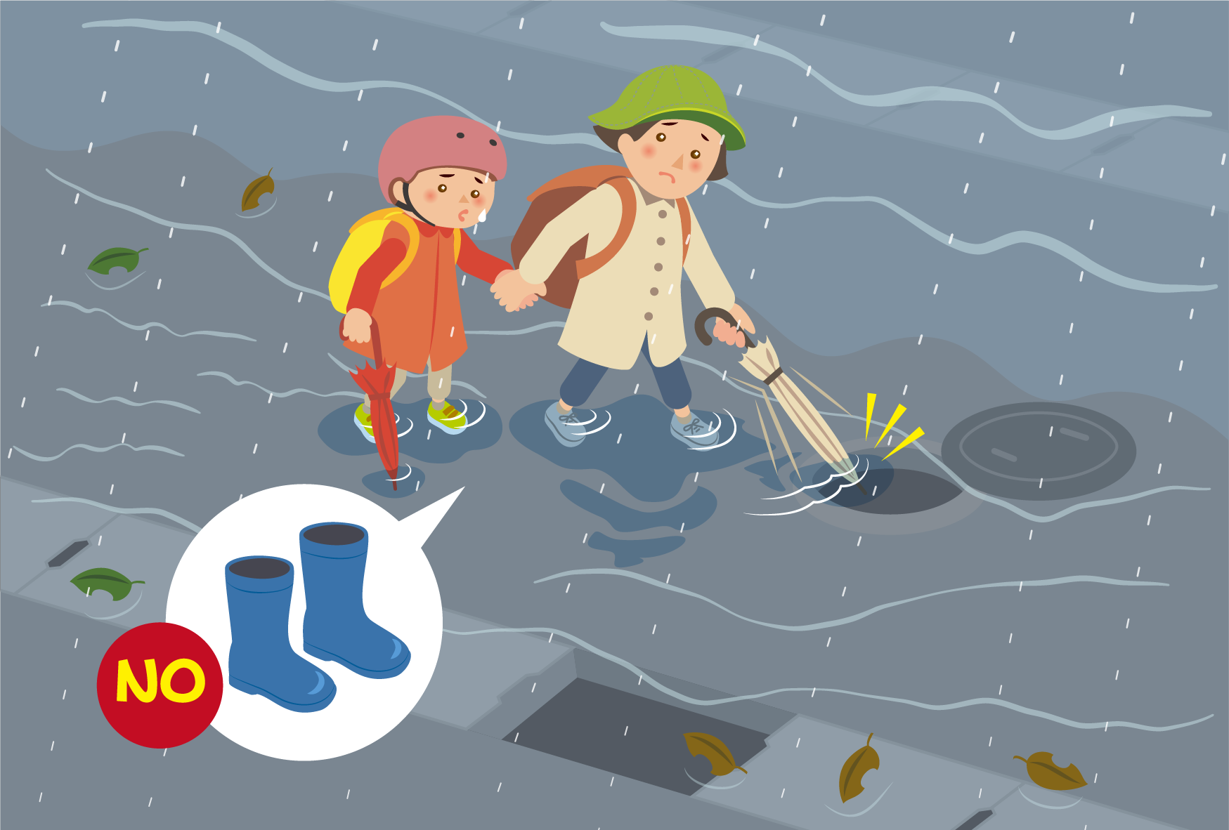
If your present location is in danger, it is important to evacuate early by going to a friend or family member's home.
Be aware of the following things when evacuating:- Evacuate on foot while it is light outside.
- If it is dark outside, use a flashlight.
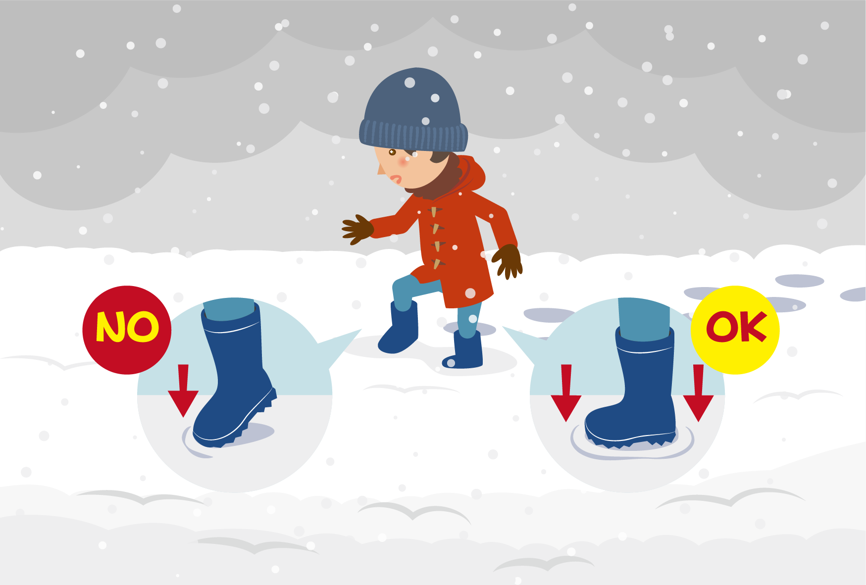
- Avoid wearing long rain boots, as they become heavy if they fill with water.
Evacuate in sneakers/trainers. - Places where water has collected can be dangerous. Use an umbrella or stick to check the depth of water while walking.
- Avoid mountains, rivers and routes below ground level.
-
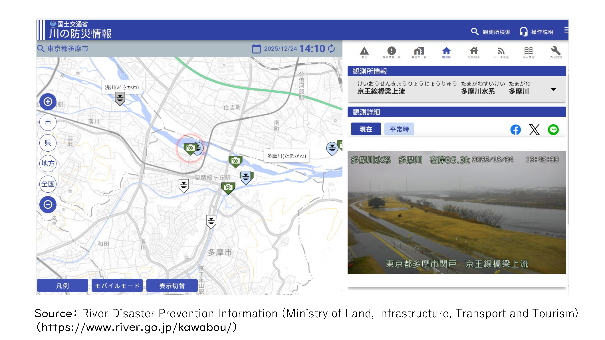
During typhoons and heavy rains, it's dangerous to go to check the state of rivers.
Flooding can occur after heavy rains. Take care even after the rain has stopped.If you want to know the state of local rivers, you can use the following site.
■River Disaster Prevention Information (Ministry of Land, Infrastructure, Transport and Tourism)https://www.river.go.jp/kawabou/(Japanese only)
How to read the river level:
① Zoom into the map with the + button until a green camera icon appears.
② Press the camera icon to see an image showing the state of the river.
-
-
Alert Levels are issued by the Japan Meteorological Agency and local governments when a natural disaster is forecast.
Alert Levels range from 1 to 5. For each alert level there are appropriate actions you should take.
If you are in a dangerous area, evacuate before the Alert Level reaches 4.
For more information on Alert Levels, see the following page.
■Alert Levels (TIPS)https://tabunka.tokyo-tsunagari.or.jp/disaster/howto/alert_levels.html(Japanese)
https://tabunka.tokyo-tsunagari.or.jp/english/disaster/howto/alert_levels.html(English)
-
■About Flood Hazard Maps (TIPS)
Hazard Maps show areas that may be affected by a natural disaster, as well as places to evacuate to in the event of an emergency.
There are different hazard maps for different disaster types and areas.For information on Hazard Maps, see the following page.
https://tabunka.tokyo-tsunagari.or.jp/disaster/howto/hazard_maps.html(Japanese)
https://tabunka.tokyo-tsunagari.or.jp/english/disaster/howto/hazard_maps.html(English)
-
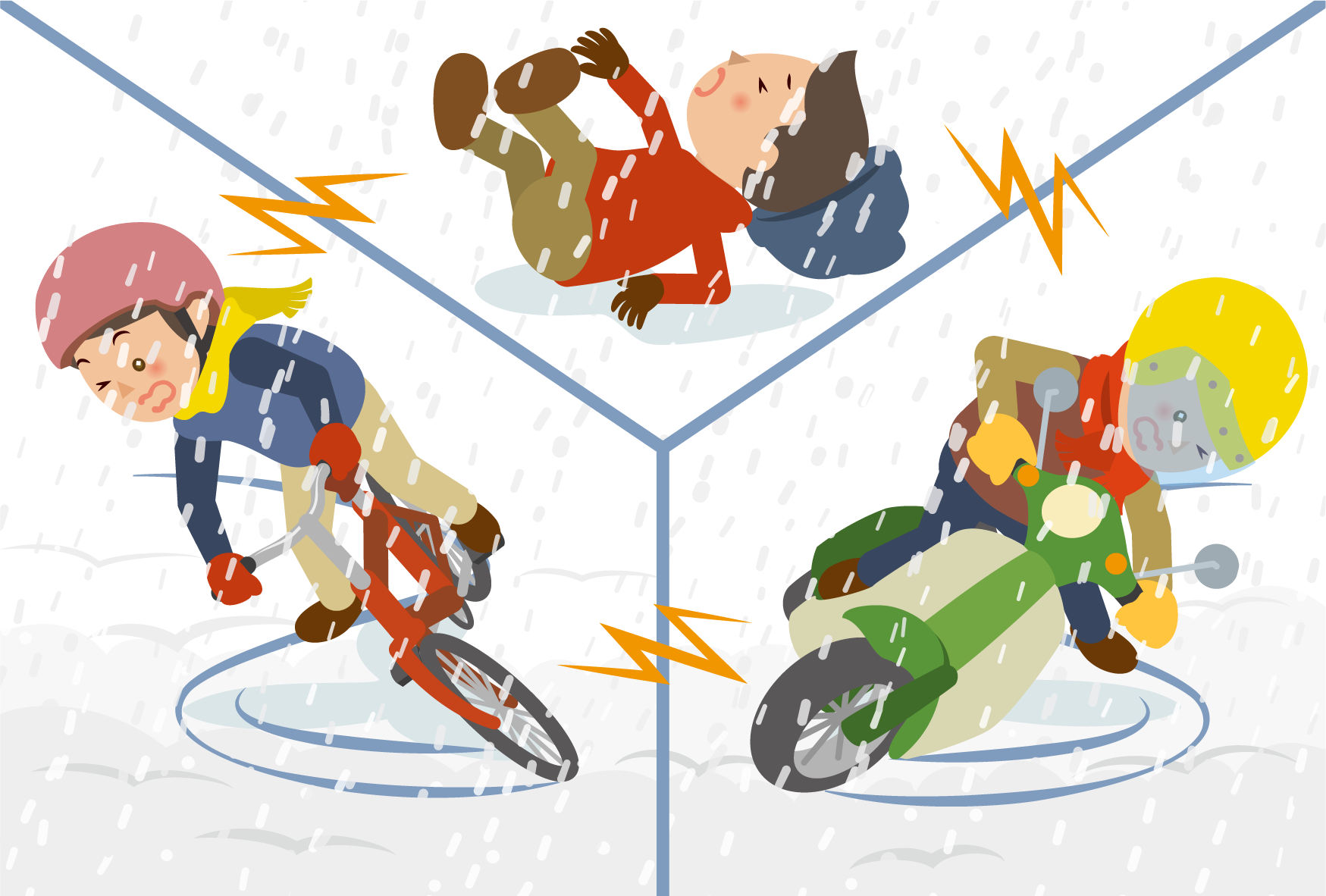
Be mindful of the following things when there is a lot of snowfall.
- Streets become slippery. Wear gloves and footwear with good grip.
- When walking, take small steps, placing the entire sole of each foot on the ground as you go.
- Train and bus services may be suspended. Check the status of public transport via news, etc.

- Bicycles and motorcycles can slide and fall, so avoid riding them in the snow.
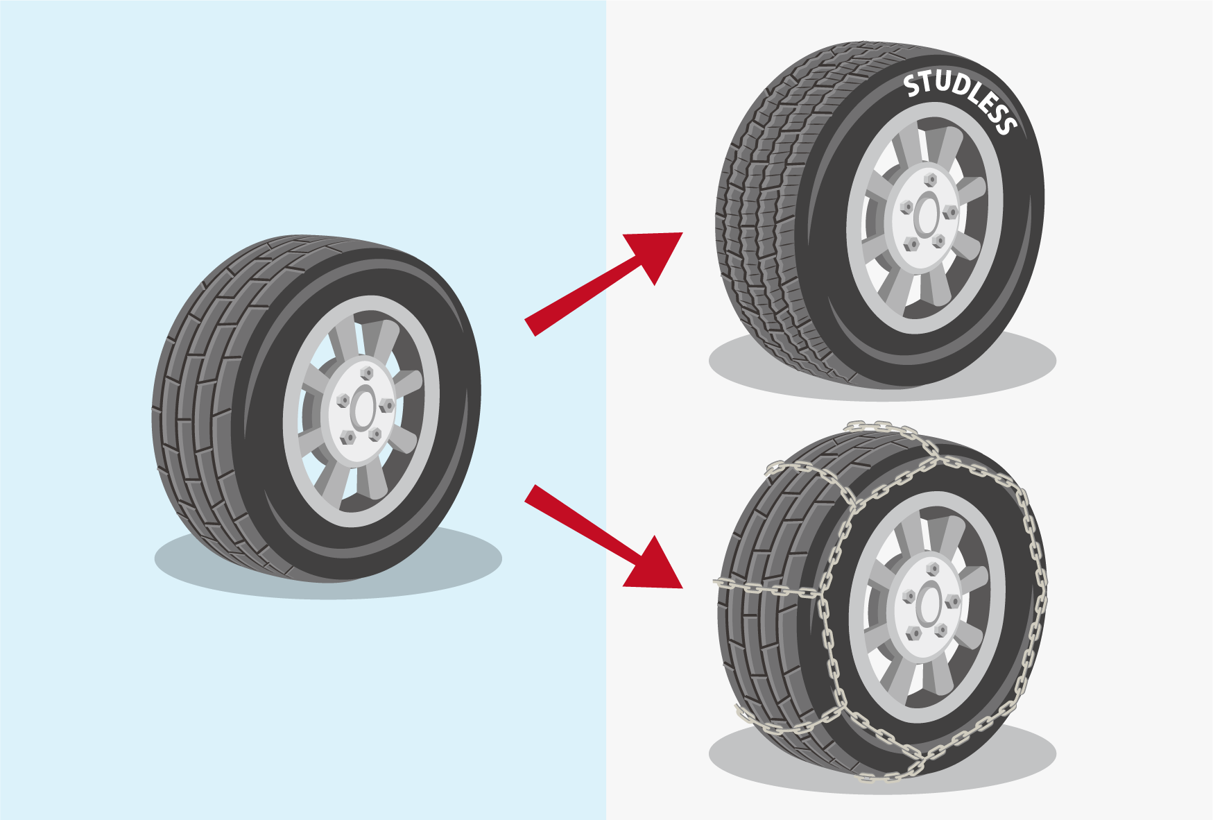
- When driving a car, use snow chains on the tires, or switch to snow tires.