Natural Disasters
KIKIKURU (Real-time Risk Maps)
What is KIKIKURU (Real-time Risk Maps)?
KIKIKURU (Real-time Risk Maps) is a website where you can look at maps during heavy rainfall or flooding to see which areas are dangerous and what the danger level is. You can access it from the Japan Meteorological Agency website.
When to access KIKIKURU (Real-time Risk Maps)
- When a warning or advisory* of heavy rain or flooding has been issued on the TV or news.
- When heavy rain has fallen.
- Warning or advisory:
A notification to take care during times when a disaster may occur.
These are issued by the Japan Meteorological Agency. A warning indicates greater danger than an advisory.
How to access KIKIKURU (Real-time Risk Maps)
-
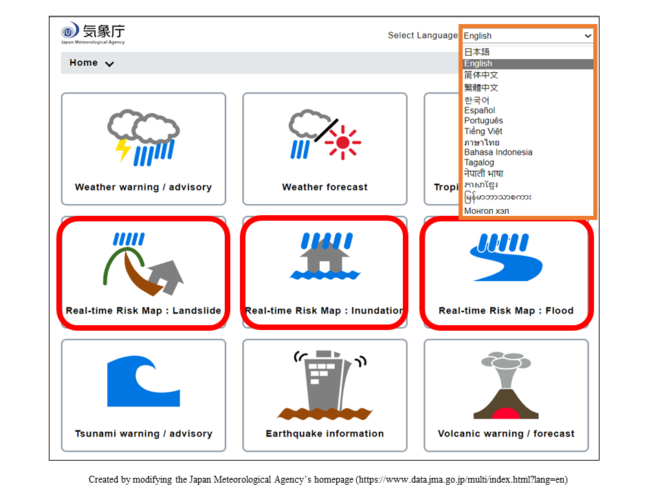
Open the Japan Meteorological Agency website
Japan Meteorological Agency website
(14 languages)
-
Open one of the following
- Real-time Risk Map: Landslide (rocks and sediment falling from mountains and cliffs)
- Real-time Risk Map: Inundation (water entering the home)
- Real-time Risk Map: Flood (river water overflowing)
-
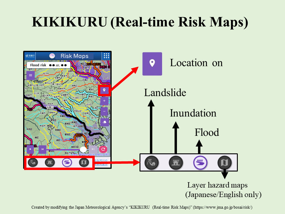
Click the “location on” button and a map of where you are now will appear.
-
Click the buttons for “landslide,” “inundation,” and “flood.”
-
Check whether your current location is dangerous.
You can tell whether your current location is dangerous by looking at the colors.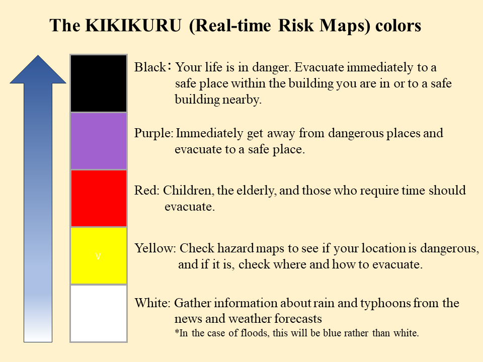
-
If your current location is dangerous, evacuate immediately.
If the map is black, get to as safe a place as possible, for example by going up a floor and far away from the window.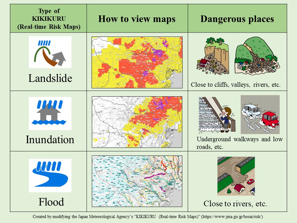
Important points when viewing KIKIKURU (Real-time Risk Maps)
If the map is black, a disaster is occurring. If your location is dangerous, evacuate until it is purple.
The maps are updated with new information every 10 minutes. If there is heavy rain, or heavy rain has fallen, check the maps multiple times.
If upriver is dangerous, downriver could become dangerous later on.
If you are near a river, make sure you also check upriver on KIKIKURU (Real-time Risk Maps).
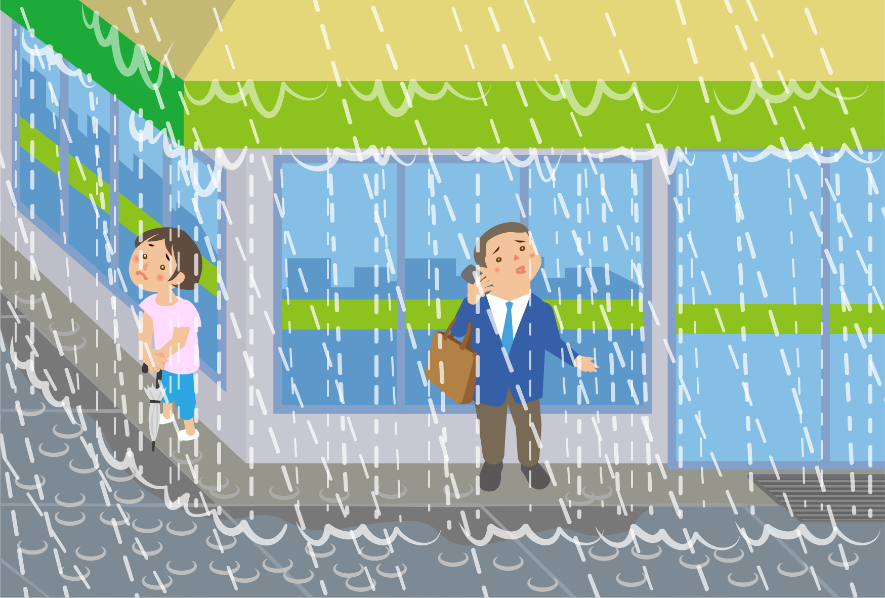
Do not go to look at the state of a river during heavy rain or a typhoon. This is very dangerous.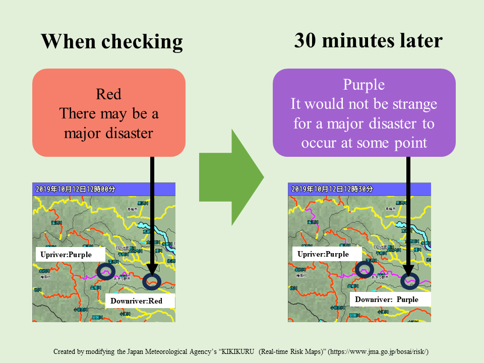
Regardless of the color of the map, if an alert level is issued by the municipality you are in, act according to that alert level.
See the page below for the actions you should take for alert levels.Alert Levels(8 languages)
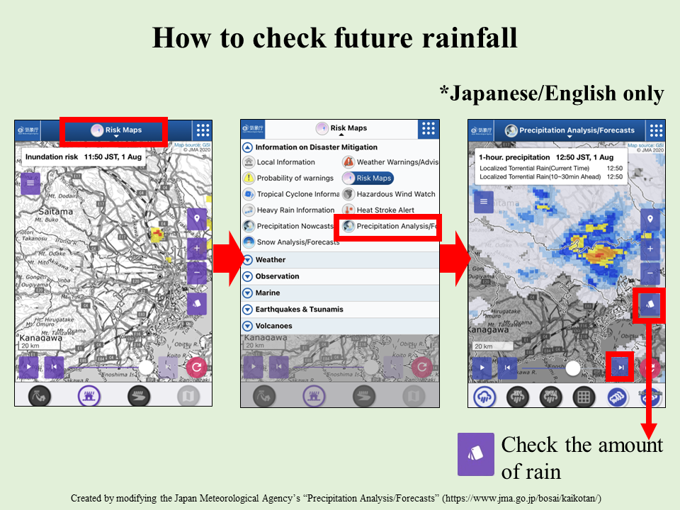
The movements of clouds that bring rain
You can use KIKIKURU (Real-time Risk Maps) to check the future movements of clouds that bring rain.
You can find out where it will rain, and how much, up to 15 hours in advance.
Check the status of your location in advance.
-
How to check (Japanese/English only)
Click on “Risk Maps” at the top of the screen.
Click “Precipitation analysis/forecasts”
Click the ▶.
The rainclouds will move on the map.
Based on the color of the clouds, you can tell how much rain there will be.