Natural Disasters
About Flood Hazard Maps
What is a Hazard Map?
A hazard map is a map showing the area where a disaster, such as a typhoon, heavy rainfall, an earthquake, etc. may strike, showing where people can evacuate to in such an event.
Each town has one or more hazard maps.
Check the hazard map for your town to see what the area around your home will be like in the event of a disaster.
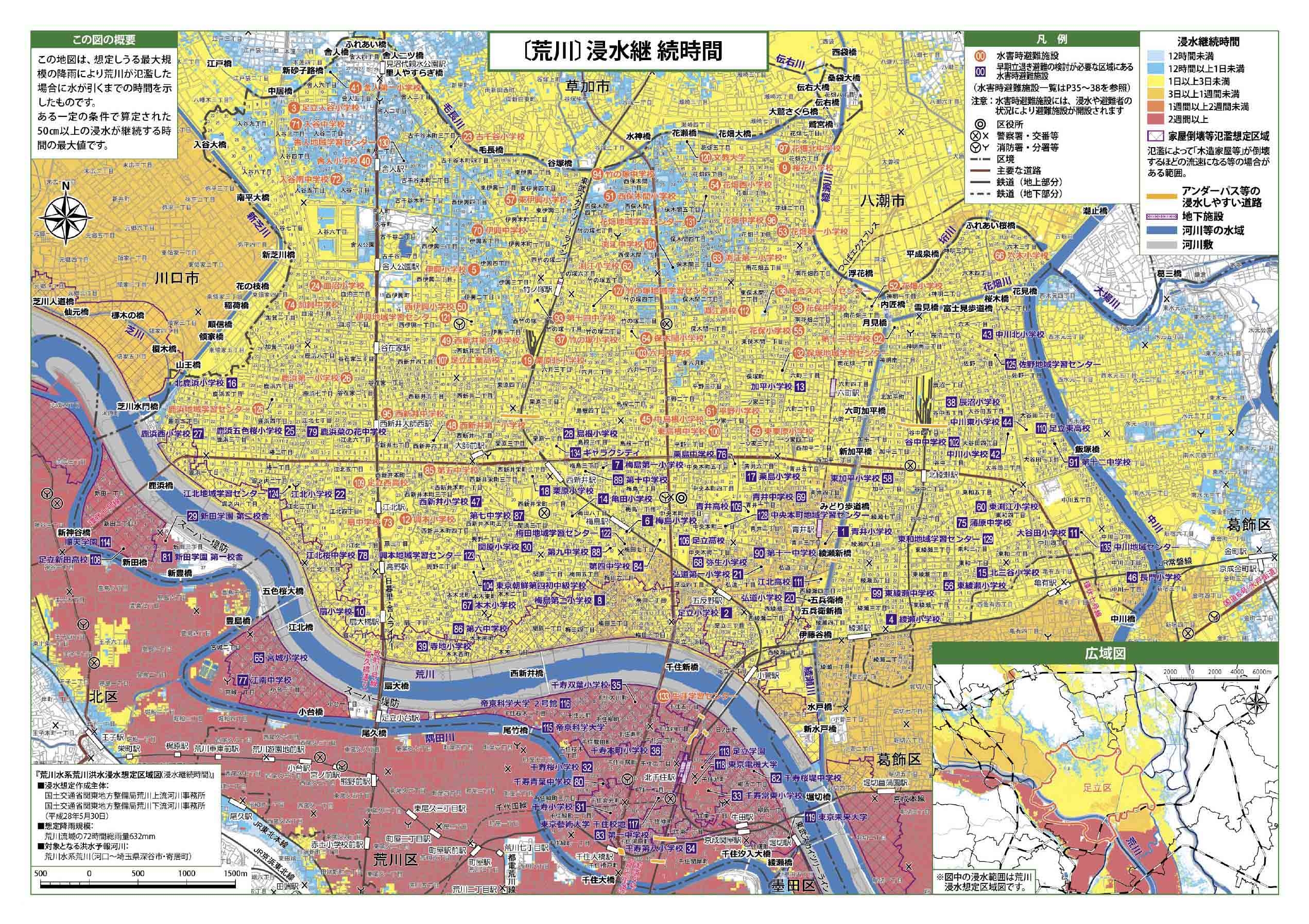
[Example: Hazard map for Arakawa]
Types of Hazard Map
There are different hazard maps for the various types of disaster, such as flood (kōzui) hazard maps, inland flooding (naisui) hazard maps, storm surge (takashio) hazard maps, and landslide (dosyasaigai) hazard maps.
-
Flood (kōzui)
When rivers overflow and water flows into a town
-
Inland flooding (naisui)
When rainwater cannot flow out to rivers, and instead overflows onto streets. This often occurs when a lot of rain falls in one spot.
-
Storm surge (takashio)
When ocean water flows into a town as a result of strong winds that cause large waves during high tide. This often occurs during typhoons or when the air pressure is low. Waves can flow up rivers even some distance from the sea.

-
Landslides (dosyasaigai)
When rain causes mountainsides or cliffs to collapse.
Hazard maps for flood disasters will show the areas where waters may reach, the water level, and how long waters will remain before receding.
There are also hazard maps for earthquakes, tsunamis, etc.
How to get a Hazard Map
You can get hazard maps at your local municipal office. You can also view them on their website. Some local authorities have hazard maps in a variety of languages.
The following page has links to the flood hazard maps for the various municipalities of Tokyo.
Click the appropriate link to open the hazard map for your area.
Tokyo Bureau of Construction (Japanese)
The site below allows you to search for various hazard maps.
Ministry of Land, Infrastructure, Transport and Tourism [Hazard Map Portal Site](Japanese)
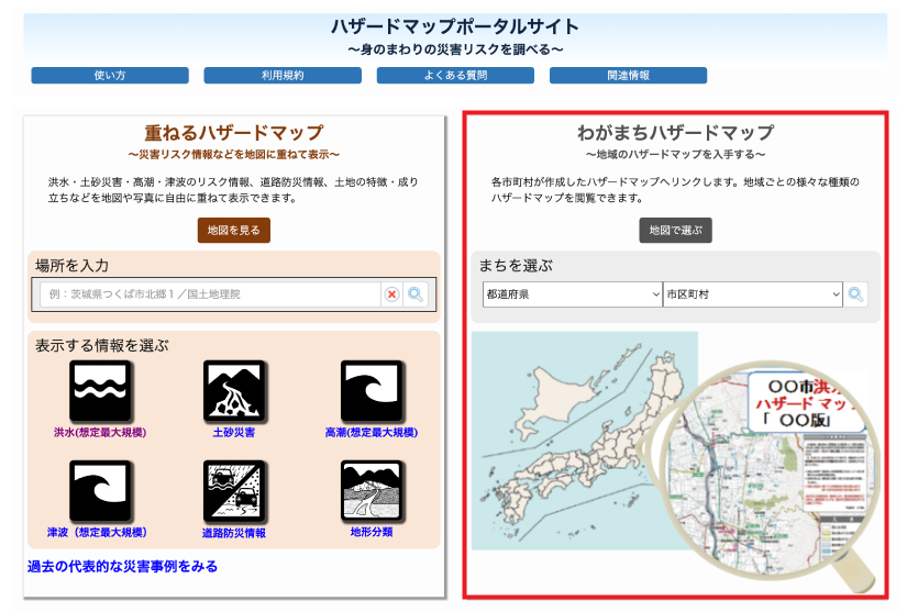
-
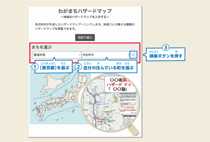
Choose the city you want to find
①Under “まちを選ぶ”, where it says “都道府県”, select “東京都” (Tokyo)
②② In "市区町村", select the town you want to find
③Press the Search icon
-
Press “リンクを開く” for the hazard map you wish to view.

-
A page with links to various hazard map(s) will open, so open the relevant file.
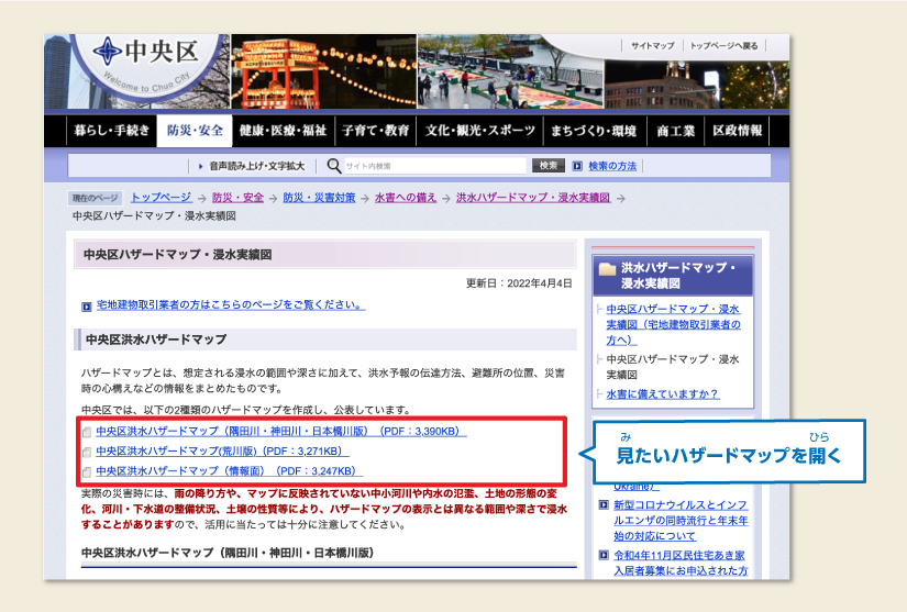
[Example: The website for Chuo-ku]
Be sure to look into how the area around your home will be affected in the event of a disaster.
Tokyo has a lot of rivers.
Check the flood hazard map and form a plan for what to do should you need to evacuate in the event of a typhoon or heavy rainfall.
“My Timeline” is a useful tool for evacuation planning.Council of Local Authorities for International Relations: “My Timeline” (Japanese)
-
How to read Flood Hazard Maps
Sometimes you will find different hazard maps for specific rivers.
Sometimes the inundation height (the height of incoming river water) and the duration of flooding are displayed on separate maps.
Check all the hazard maps for your town and look for the following information: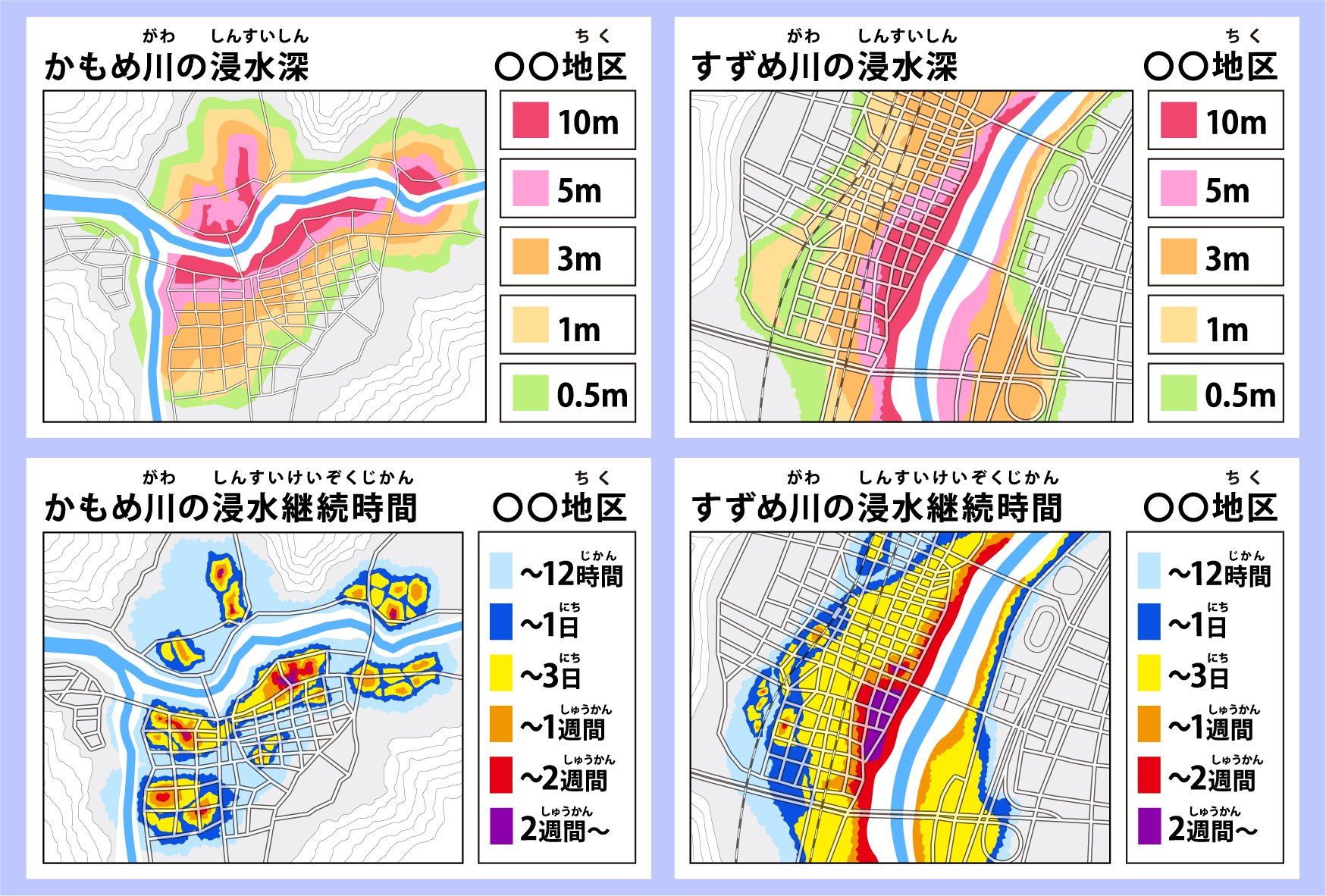
-
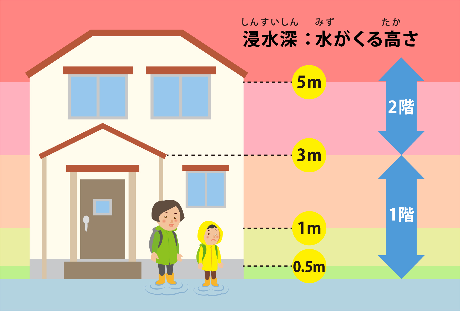
The inundation height for your area (shinsui-shin).
Look at the picture below to see how far the water will rise based on the height.
-
The flood duration for your area (shinsui-keizoku-jikan).
-
Check if your area is expected to experience floods that will destroy homes (kaoku-tōkaitō-hanran-sōtei-kuiki).
After checking ① - ③, make a plan for when, where, and how to evacuate.
-
The inundation height for your area (shinsui-shin).
-
How to read Flood Hazard Maps
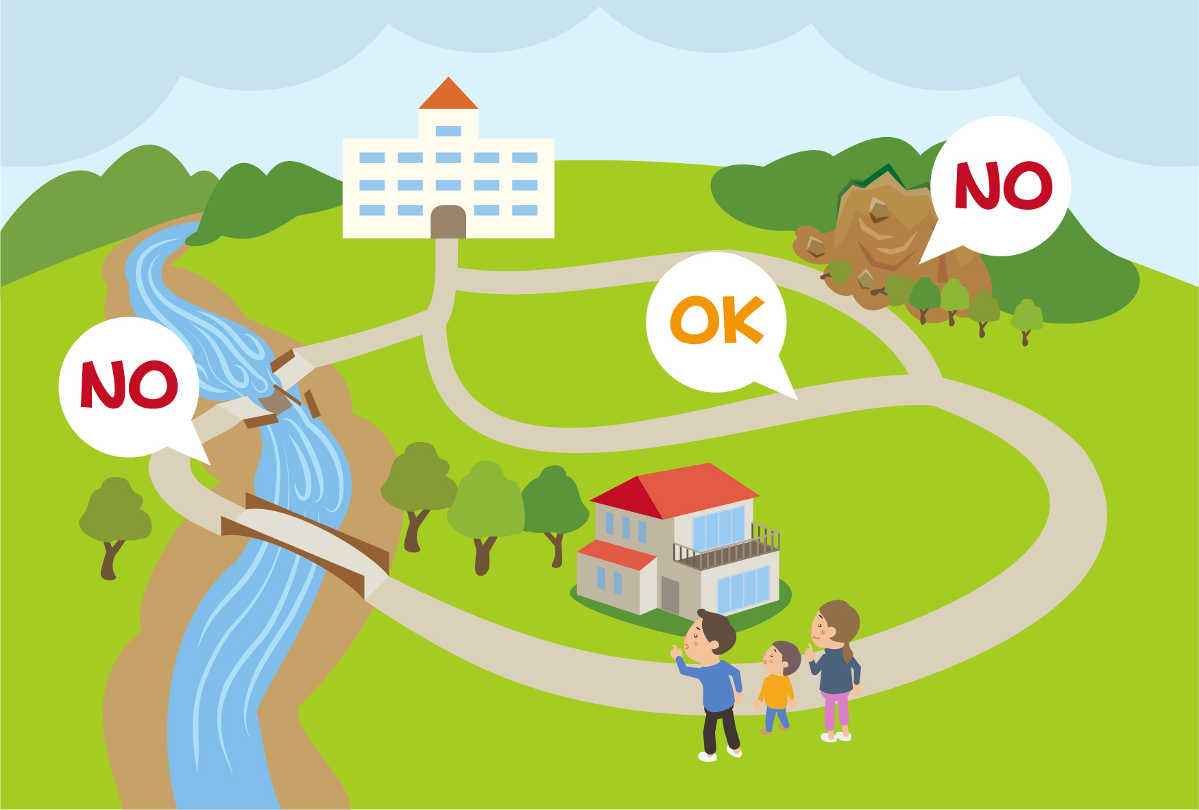
Where to evacuate to
Depending on the height (①) of the incoming water, think about where best to evacuate to.
-
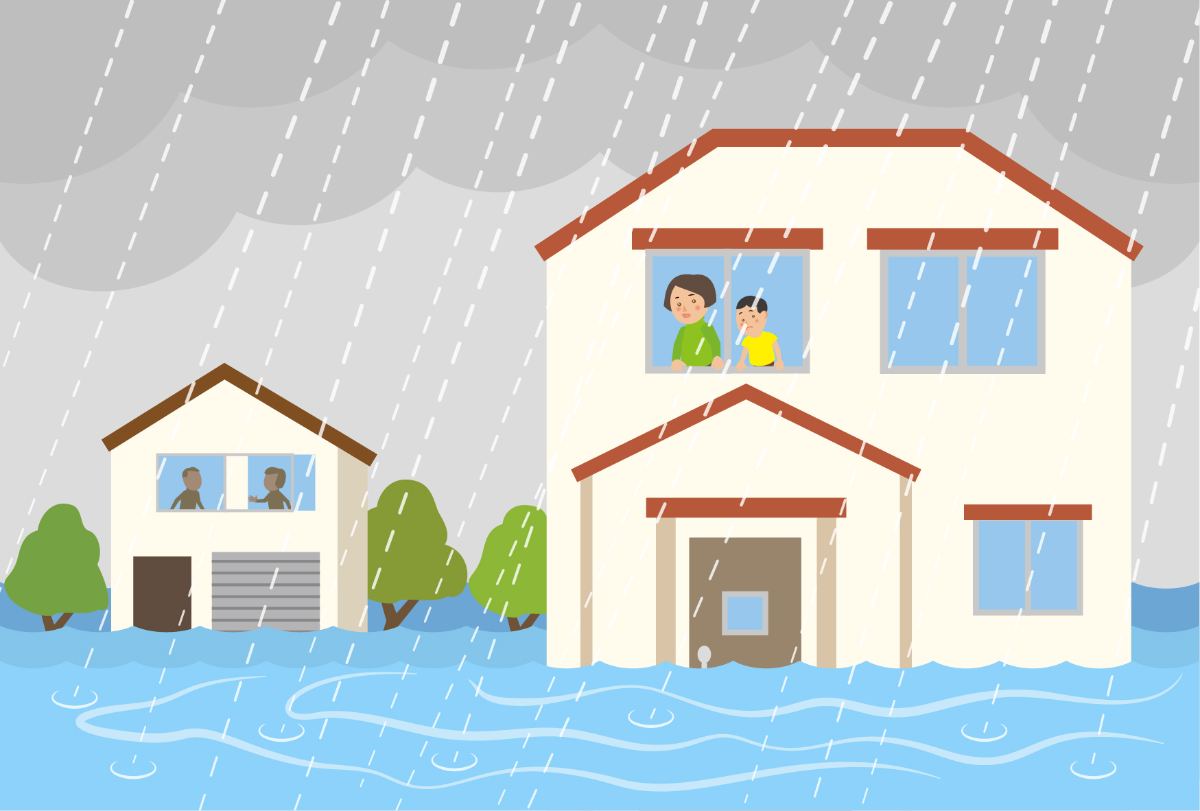
Evacuate to a higher part of your home
-
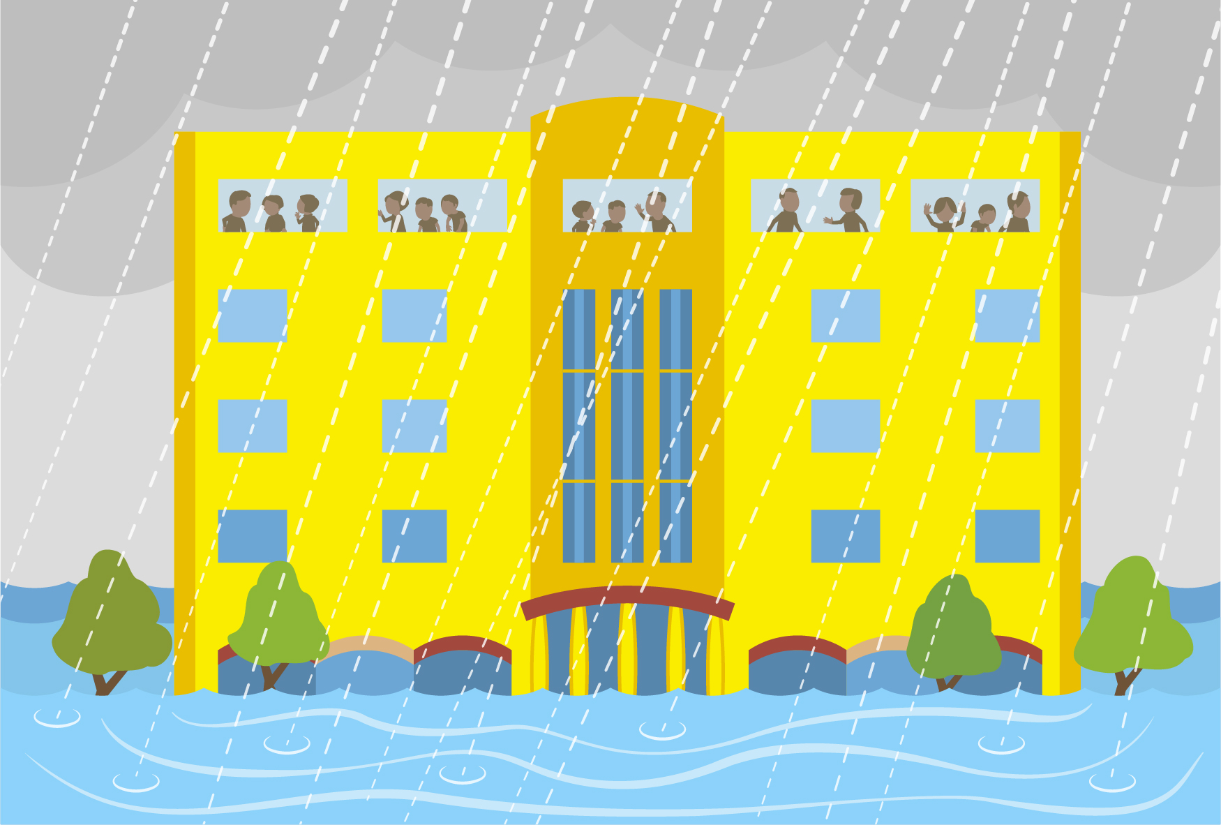
Evacuate to the top floor of your building
-
Evacuate to somewhere safe outside your home
If on checking (③) you see that buildings in your area may collapse, evacuate to somewhere safe.
Think of a few places you might flee to:
- Somewhere safe, like an evacuation center
- A strong building nearby where river waters won't reach
- A friend or family member's home where river waters won't reach
How to evacuate
Once you have decided where to evacuate to, think about how you will get there (on foot/by train/by car) and how long it will take to get there.
Choose a safe route.
Things to prepare
Prepare items you will need if you cannot go outside due to flooding, or that you will need if you have to evacuate.
Think about the quantities of items you will need based on how long the flood waters will take to recede after checking (②) above.
-
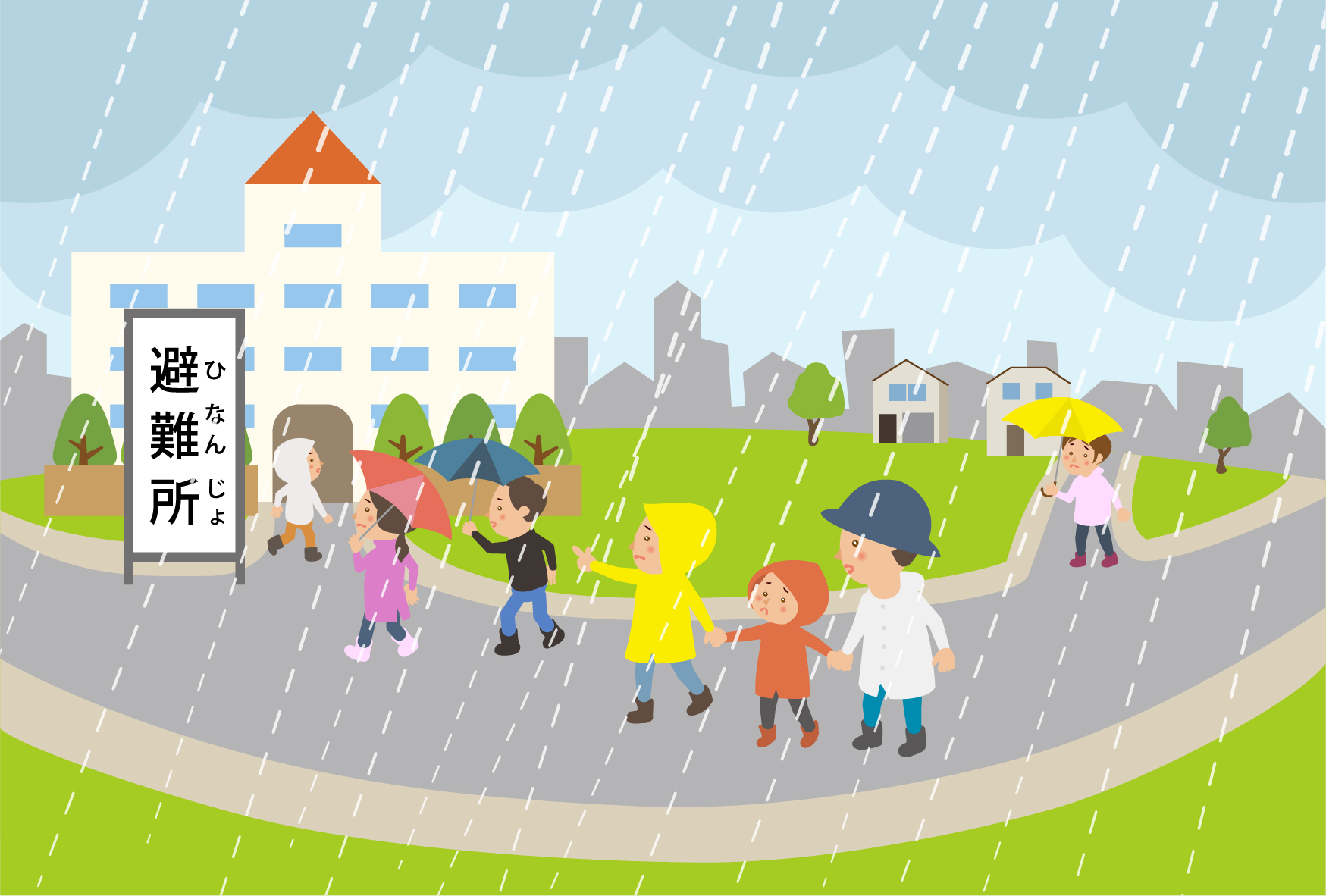
In the event of a typhoon or heavy rainfall
When there is a risk of a typhoon or heavy rainfall, make use of the evacuation plan you made here. Pay attention to the Alert Levels for your area, announced by the Japan Meteorological Agency and by local authorities, and decide when and where you should evacuate.
Alert Levels (8 Languages)